Florida floods as possible Tropical Storm Kyle brews
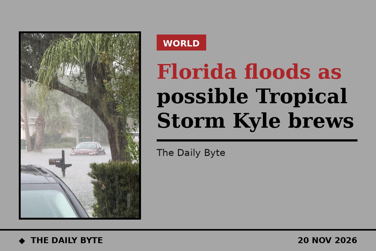
Heavy rain is flooding streets across eastern Florida on Friday 20 November as a broad area of low pressure off the state's east coast threatens to develop into a subtropical or tropical storm. The system would be named Kyle, the next name on the 2026 Atlantic hurricane season list, if it strengthens.
The National Hurricane Center said in its outlook issued at 1 a.m. EST on Friday that the low, sitting near the east coast of central Florida, had a 30 percent chance of developing over the next 48 hours and a 50 percent chance over the next seven days. The centre stressed that regardless of whether the system becomes a named storm, heavy rainfall and flash flooding would continue across the Florida peninsula on Friday, according to Florida Today.
What the Hurricane Center says
Surface observations show the low producing disorganised showers and thunderstorms stretching from the central Florida peninsula eastwards over the Atlantic. The Hurricane Center said the system could acquire subtropical or tropical characteristics as it moves generally northward to north-eastward near or just offshore of the south-eastern United States coast through the weekend.
Even without development, the centre warned of strong gusty winds, dangerous surf, rip currents and coastal flooding along parts of the south-east and mid-Atlantic coasts into early next week, and said residents along the eastern seaboard should keep monitoring the system. The 2026 Atlantic hurricane season officially ends on 30 November, although storms can form after that date. As of 20 November there have been 10 named storms and one hurricane this season; Hurricane Isaias formed in the Gulf and made landfall near Destin on 9 October with 105 mph winds.
Flooding already under way
Florida has already endured days of heavy rain. A flash flood warning was issued on Friday morning for parts of Brevard, Seminole and Volusia counties until 12:30 p.m. ET, and the National Weather Service in Melbourne posted a high risk of excessive rainfall and dangerous flash flooding for parts of Brevard and Volusia counties. Forecasters said the most likely rainfall was two to six inches across east-central Florida, with a reasonable worst case of eight to 12 inches through Friday night in coastal north-east Florida.
Several Florida schools are closed again on Friday, giving some pupils an early start to the Thanksgiving break. Broward County has declared a state of emergency, closed schools and shut some government offices. In Brevard County, first responders have already rescued at least two people from rising water, and in Cocoa a pregnant woman called for help as flood waters entered her home. The St. Johns River near Cocoa topped its record high in the early hours of 19 November and continued to rise, USA Today reported, with between four and six and a half inches falling in 12 hours in parts of central Brevard County.
Thanksgiving travel warning
As the system moves north, the threat will spread to the southern United States and the mid-Atlantic coast into early next week, just as Thanksgiving travellers take to the roads and airports. The rain is expected to reach Georgia and the Carolinas, then Washington DC and Baltimore, then the north-east and New England. Waves could reach 10 or 11 feet in surf zones along the coasts of Florida and south-eastern Georgia. Forecasters urged drivers never to drive through flooded roads, where the depth of the water is often impossible to judge.
Photo: a flooded street in Florida during the heavy rain. Source: Fox Weather.