Iran Digging New Underground Base Near Isfahan, Images Show
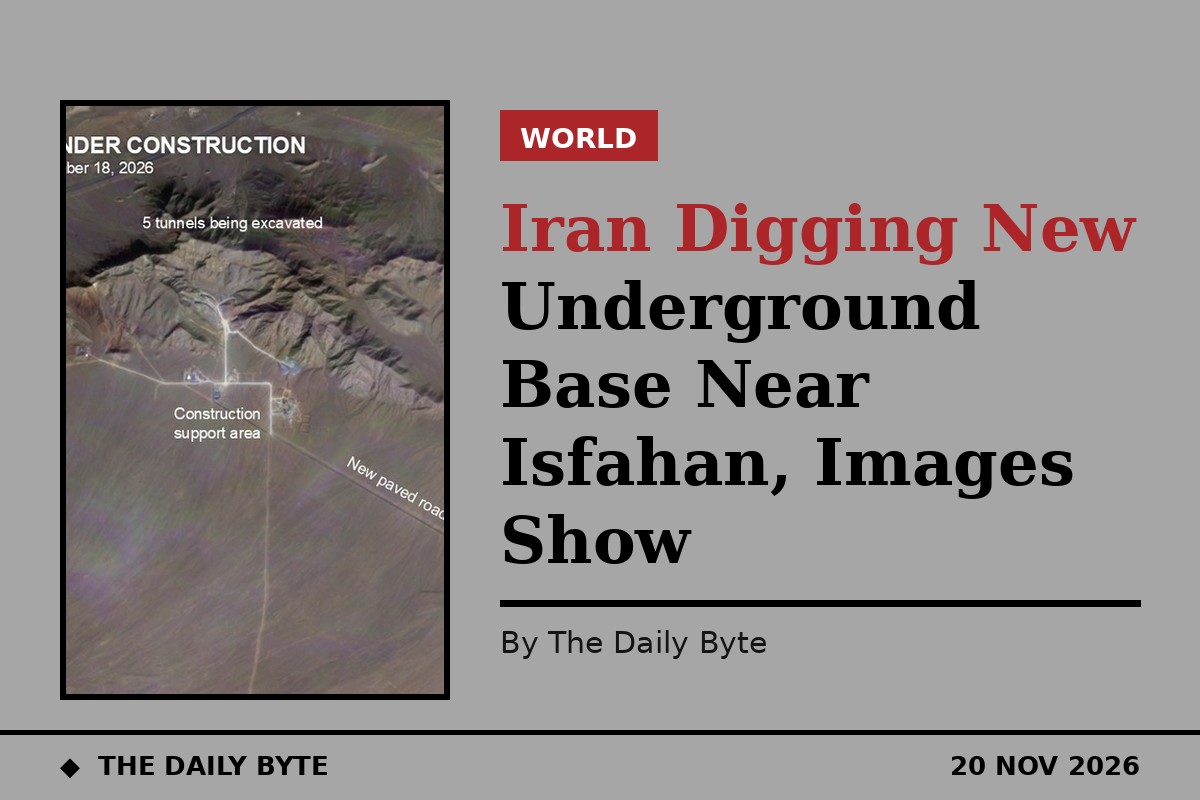
Iran is digging a large new underground facility in the mountains north of Isfahan, according to open-source analysis of satellite imagery published on Wednesday, in a project that one missile analyst assesses is likely a new Revolutionary Guard missile base.
Sam Lair, a missile analyst who has worked with the James Martin Center for Nonproliferation Studies, published his findings on 19 November in an analysis for Arms Control Wonk, based on imagery from Planet Labs. The site sits at 33.148 degrees north, 51.782 degrees east, near Behjatabad, and excavation there began in January 2026.
Iran has not commented on the site, and the assessment has not been independently confirmed. But the imagery shows a substantial construction effort that has continued despite the war with the United States and Israel.
What the satellite images show
According to Lair, Iranian crews have built new paved and unpaved roads, staging areas, construction support buildings and a small bermed area, probably used to store explosives for the excavation. Activity is visible at the tunnel mouths, the spoil piles and a concrete production site.
Based on the images so far, the facility will have five tunnel entrances. A timelapse of daily Planet imagery shows the pace of construction, and work has continued through the war rather than stopping when the fighting began.
One detail in the imagery caught Lair's attention. The crews first tried to dig into the western face of the mountain but gave up after a few months. The spoil from those abandoned entrances is a very different colour, red or burgundy rather than the grey and gold from the entrances still under construction, which suggests the geology on the western face may have been unfavourable for tunnelling.
How deep the tunnels could go
Using elevation data from Google Earth, Lair estimated that tunnels driven straight into the western arm of the valley could sit about 150 metres below the surface. If they turn into the heart of the mountain, he said, they could reach 200 metres or more.
For comparison, he noted that the Fordow enrichment plant was estimated at 80 to 100 metres deep, which could make the new site harder to hit with ground-penetrating munitions than the nuclear site.
“Based on the early phases of construction, I think this is a new missile base for the IRGC-ASF,” Lair wrote, referring to the Revolutionary Guards' Aerospace Force. He said the tunnel entrances and the location resemble those seen at other missile bases across Iran.
Why analysts urge caution
Lair himself stressed that the identification is provisional. A firmer call, he wrote, requires aboveground features characteristic of missile bases, such as missile checkout buildings and garages. If Iran completes the work without adding them, he said, analysts would have to reconsider what the site is.
The finding fits a wider pattern reported this month. BBC Verify reported on 6 November that satellite images showed major construction near other Iranian missile sites, including the Garmdareh base at Karaj near Tehran and the Shahroud base in the north, as well as repairs at bases damaged by months of United States and Israeli air strikes.
Analysts quoted in that report said Iran has a pattern of moving infrastructure underground to protect it from further strikes. Whatever the new Isfahan site turns out to be, Lair concluded, it is one to watch.
Sources: Arms Control Wonk | Clash Report