Storm Charles Heads for Portugal and Spain
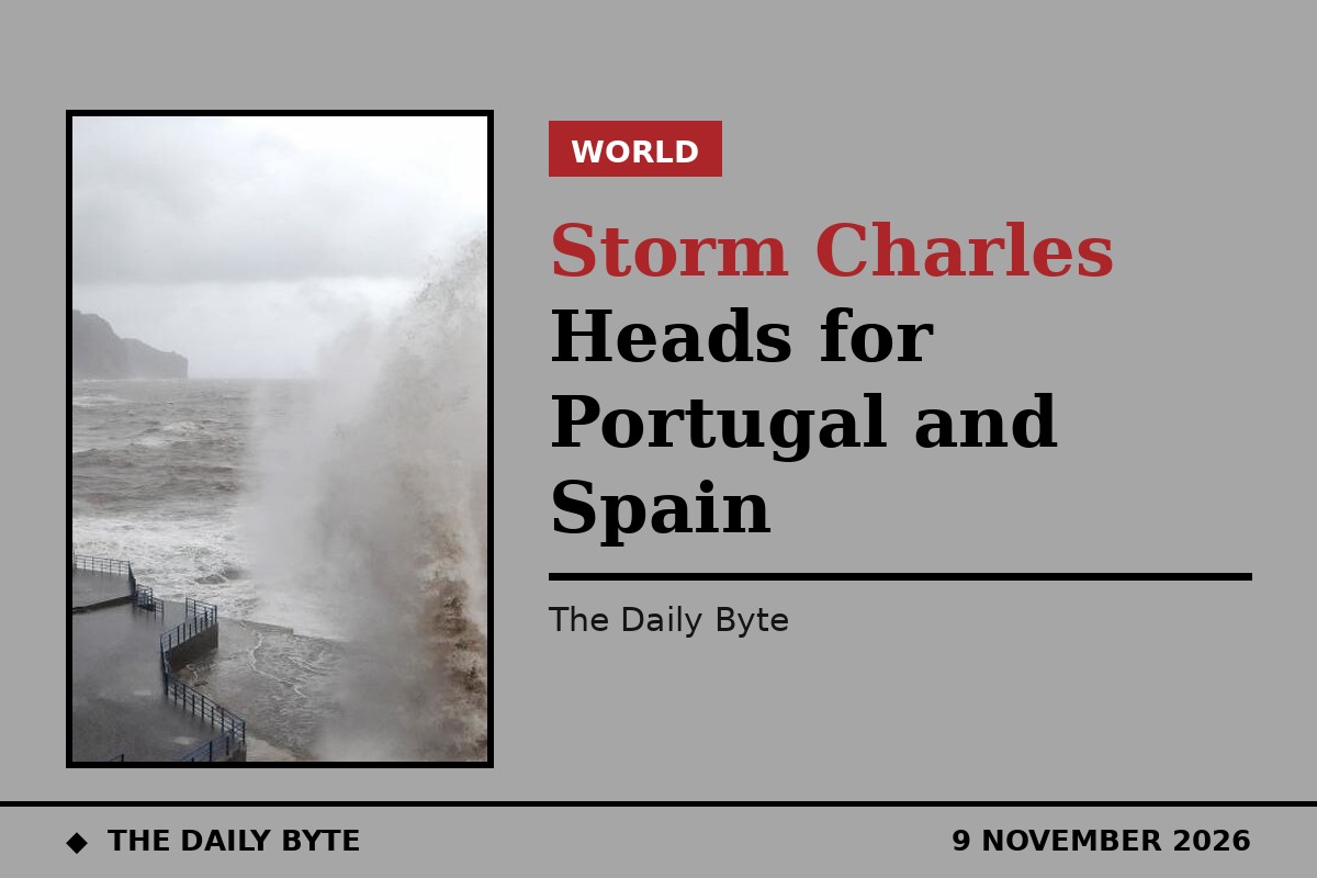
Portugal and Spain are preparing for another major Atlantic storm, after Portugal's weather service named Storm Charles on Monday, 9 November 2026. The system is expected to bring torrential rain, gusts of up to 130 kilometres per hour and dangerous seas to Madeira, mainland Portugal and south-west Spain, with Wednesday, 11 November, set to be the worst day.
Charles is the third named storm of the 2026/27 season, after Adam and the current storm Bruna. It formed in the subtropics, and the Portuguese Institute for Sea and Atmosphere (IPMA) named it as it moved eastwards across the Atlantic. At the time of the announcement it was centred near 33 degrees north and 31 degrees west, with a pressure of about 994 hectopascals, and forecasters expect it to strengthen as it approaches Madeira.
Madeira first in line
Madeira will feel the storm first. Conditions are expected to worsen from late on Tuesday, 10 November, into Wednesday morning, with persistent and at times heavy rain. More than 100 millimetres of rain could fall within 12 hours in some areas, especially in the island's mountainous interior, where heavy rain can quickly run down into valleys and coastal towns.
South-westerly winds are forecast to gust at 80 to 100 kilometres per hour, reaching about 130 kilometres per hour on high ground. Waves of 3.5 to 4.5 metres are expected along Madeira's southern coastline. IPMA has issued orange-level warnings for the island, the second most serious level, and has not ruled out raising them further as forecasts are updated. The Porto Santo Line has cancelled its ferry sailings for Wednesday, moving replacement trips forward to Tuesday.
The timing is difficult for Madeira, which is still dealing with the effects of Storm Bruna. Bruna caused flooding across the island over the weekend, left ten people homeless, and one person is still missing. Dozens of flights were cancelled at Funchal airport between Saturday and Sunday.
Mainland Portugal and Spain
On the Portuguese mainland, the weather linked to Charles is expected to deteriorate from late on Wednesday morning. IPMA forecasts gusts of 100 to 120 kilometres per hour, locally higher, with rain heavy at times across much of the country. Waves of four to six metres are forecast along the coast south of Cabo Carvoeiro from Wednesday afternoon. Orange warnings will be issued, with the possibility of an upgrade. The Azores are not expected to be affected.
In Spain, the national weather agency AEMET has issued a special statement covering Tuesday, 10 November, to Thursday, 12 November, identifying Wednesday as the most severe day. The storm is expected to reach the south-west of the Iberian Peninsula on Wednesday afternoon, with the Gulf of Cadiz hit first. Western Andalucia, Extremadura and Ceuta could see the worst conditions, along with central and southern Portugal, according to forecasters at Meteored.
Meteored has warned that a tornado is possible if the storm strengthens rapidly as forecast, with the subtropical moisture it is carrying fuelling intense downpours and thunderstorms. Gusts of 100 to 120 kilometres per hour could whip up rough seas along Andalucia's Atlantic coast. Charles is then expected to track north-east across the peninsula on Thursday, bringing further bursts of heavy rain and strong winds before weakening as it reaches northern Spain.
Canary Islands and safety advice
The Canary Islands will also feel the storm, most likely on Wednesday and to a lesser extent on Thursday. The strongest effects are expected in the western islands, where gusts could exceed 120 kilometres per hour in exposed areas. Lanzarote has yellow-level wind warnings for Wednesday, with gusts of around 70 kilometres per hour, and a coastal warning from around midday.
Spain's Civil Protection authorities have warned that rainfall across the whole period affected by Bruna and Charles could locally exceed 300 millimetres in the Central System mountains, raising the risk of rivers overflowing, flash flooding and landslides. People have been urged not to cross flooded areas on foot or by car, to avoid coastal areas exposed to rough seas, and to secure loose objects on balconies and in gardens. Forecasters stress that the storm's exact track is still uncertain, and its intensity may change with each update.