What Is a Cold Snap? Why the UK Is Freezing Tonight
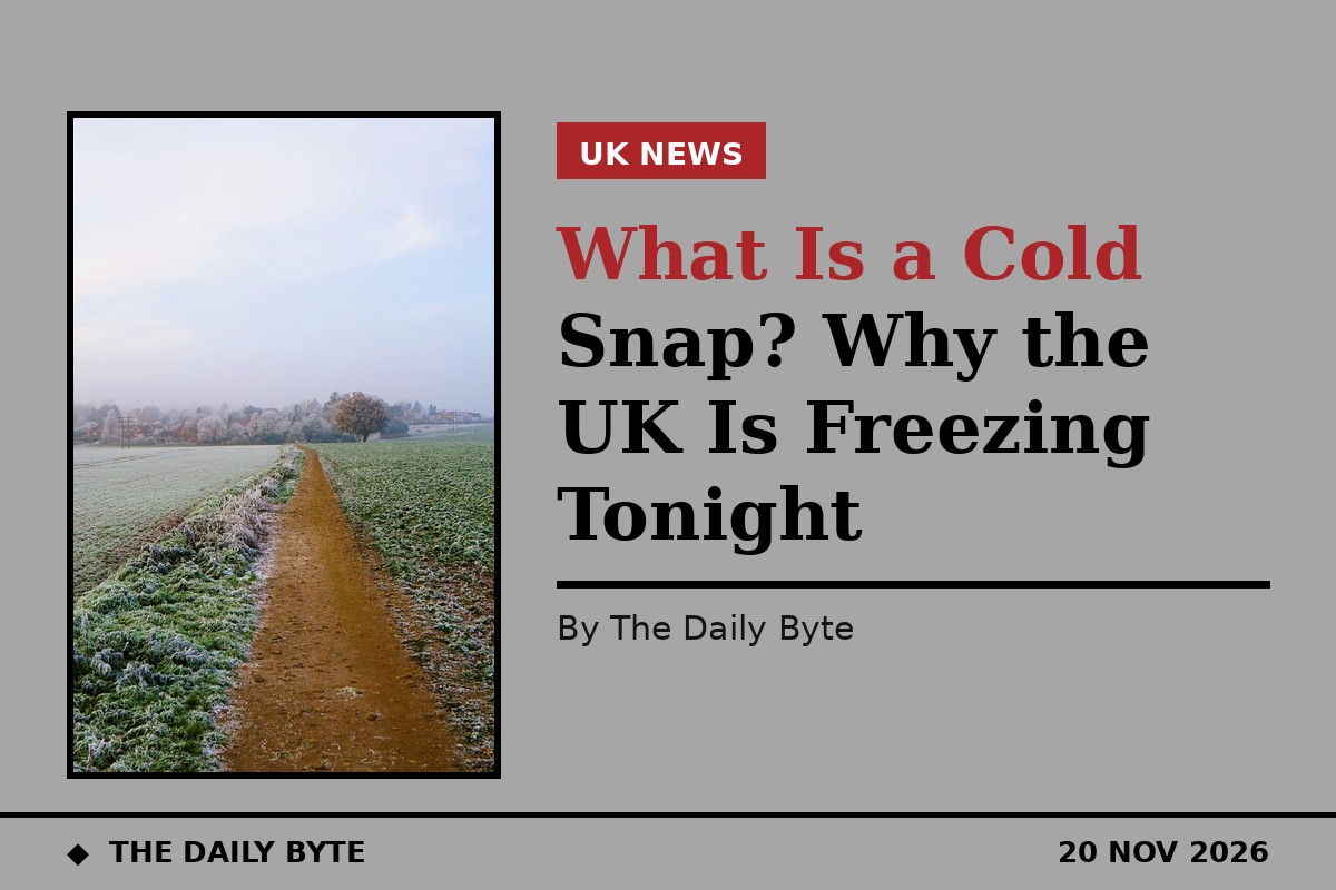
Friday night is set to be the coldest night of the autumn so far across the UK. Temperatures fell to minus 8.4C at Tulloch Bridge in the Scottish Highlands on Thursday night, the coldest reading of the season, and forecasters say Friday night could be colder still, with lows of around minus 8C or minus 9C in sheltered parts of Scotland and northern England, and possibly minus 10C in a Scottish glen. Yellow cold-health alerts are in force across northern England.
The cause is what forecasters call a cold snap: a sudden, short-lived plunge into much colder weather. This explainer sets out what a cold snap actually is, why this one is happening, why Scotland bears the brunt of it, and how to stay safe while it lasts.
What a cold snap is
A cold snap is a short period of unusually cold weather that arrives suddenly and lasts for a few days, rather than a whole season of cold. It is not a technical term with a single fixed definition. Forecasters use it for a sharp drop in temperature well below what is normal for the time of year, usually driven by a change in where the air over the country is coming from.
The key point is that a cold snap is about the air mass, not just the thermometer reading. Britain's weather is usually dominated by mild, damp air arriving from the Atlantic to the west and south-west. A cold snap happens when that flow is replaced by air from a much colder place, most often the Arctic to the north. The temperature can fall by ten degrees or more in a day, and nights that were mild become frosty.
Cold snaps are a normal part of the British climate, and they happen most often in late autumn and winter. They are different from a cold spell, which is simply a longer run of cold weather, and from a named storm, which brings wind and rain as well as cold. A cold snap can also be surprisingly local: one valley can be several degrees colder than a town a few miles away, which is why the coldest readings are often recorded in the same handful of places.
Why tonight is so cold
Three ingredients have come together for this cold snap. The first is the source of the air. A northerly wind is dragging cold Arctic air southwards across the UK, and the BBC has described the recent chill as cold Arctic air temporarily sweeping across the country. Arctic air starts out far below freezing, and although it warms as it travels, it can still arrive in Scotland several degrees below zero.
The second ingredient is high pressure. A ridge of high pressure is sitting over the UK, bringing settled, dry weather with light winds. High pressure suppresses cloud, and cloud acts like a blanket at night, trapping heat near the ground. With clear skies, the heat the ground absorbed during the day escapes freely into space after sunset, and the temperature falls fast. Forecasters call this radiational cooling, and it is the reason the coldest nights are usually the clearest ones.
The third ingredient is snow cover. Parts of Scotland already have lying snow, and snow reflects what little warmth the low autumn sun provides, while also chilling the air directly above it. That is why the Met Office expects the lowest temperatures in rural parts of Scotland with snow on the ground. The combination of Arctic air, clear skies, light winds and snow cover is what turns an ordinary cold night into a record-chasing one.
Why Scotland gets the coldest nights
Scotland records the UK's lowest temperatures so often that it is worth asking why. Latitude is part of it: Scotland is further north, so it receives less sunshine and is closer to the source of Arctic air. Altitude is another: much of the Highlands sits hundreds of metres above sea level, and temperature falls with height. But the biggest factor is the shape of the land.
On a calm, clear night, cold air behaves almost like water. It is denser than warm air, so it flows downhill and pools in valleys and hollows, a process called cold-air drainage. Sheltered glens in the Highlands are perfect traps for it, and the temperature at the bottom of a glen can be several degrees lower than on the hillside above. Tulloch Bridge, where Thursday night's minus 8.4C was recorded, sits in just such a setting in the Scottish Highlands. Forecasters say a rural glen could reach minus 10C on Friday night, and the Met Office's chief forecaster, Matthew Lehnert, said the lowest temperatures are expected in sheltered rural parts of Scotland and far northern England, with lows of around minus 8C or minus 9C.
The same effect explains why towns and cities are warmer. Buildings, traffic and human activity all release heat, and the urban heat island effect can keep a city several degrees above the surrounding countryside on a frosty night. Edinburgh, Glasgow and other Scottish cities are expected to fall to around minus 3C, cold, but far above the minus 9C or minus 10C possible in a Highland glen.
Frost, freezing fog and ice
A cold snap brings more than low temperatures. As the air cools overnight, moisture in it condenses and freezes on cold surfaces, forming frost. With clear skies and light winds, the frost on Friday night is expected to be widespread, extending southwards through the night and covering much of the country by morning. Gardeners will recognise the damage it does to tender plants; drivers will recognise it on windscreens and roads.
Freezing fog is another hazard of these nights. Fog forms when the air cools to the point where its moisture condenses into tiny droplets, and if the temperature is below freezing, those droplets freeze on contact with surfaces, coating trees, fences and cars in white rime. Forecasters have warned of freezing fog patches, particularly across central and southern areas and in Northern Ireland, and fog can make driving dangerous by cutting visibility to a few metres.
Ice is the most dangerous consequence. Rain or melted snow that refreezes overnight can leave roads and pavements treacherously slippery, especially on untreated surfaces, bridges and shaded stretches. The risk is highest in the early morning, before the sun has had a chance to warm the ground, and it is one reason the authorities advise extra care on the roads after a frosty night.
How cold is this compared with the records?
Thursday night's minus 8.4C at Tulloch Bridge was the coldest night of the autumn so far, beating the previous low of minus 7.7C recorded at the same place on 16 November. Friday night is forecast to go lower still. But the figures, striking as they are, are a long way from the UK's cold records.
Last November, Moray recorded minus 12.6C, the coldest November night in 12 years. The coldest November night ever recorded in the UK was in 1912, when Cumbria dropped to minus 16.1C. The UK's all-time lowest temperature, minus 27.2C, was recorded in Braemar in the Scottish Highlands, twice: in February 1895 and again in January 1982. A forecast of minus 10C in a Highland glen is therefore severe for November, but it is not in the same league as the historic extremes.
What makes this cold snap notable is its timing and its reach. It is arriving in the third week of November, before winter has properly begun, and it is bringing sub-zero temperatures to much of the country, not just the Highlands. Temperatures of minus 1C to minus 5C are widely forecast from the Midlands northwards, and Londoners have been warned to prepare for several nights close to freezing.
Health alerts and staying safe
Cold weather is a health risk, not just an inconvenience, and the authorities treat it as one. The UK Health Security Agency, working with the Met Office, has issued yellow cold-health alerts for the North West, the North East and Yorkshire and the Humber. The alerts warn that cold weather can affect health, particularly for older people, young children and those with heart, lung or circulation conditions.
The advice during a cold snap is straightforward. Keep living rooms warm and wear extra layers, especially at night. Check on older relatives and neighbours, and make sure they have heating, food and any medicines they need. Keep bedroom windows closed on the coldest nights, and leave heating on low overnight if pipes are at risk of freezing. Anyone who has to drive should allow extra time, clear all ice and snow from the vehicle before setting off, and be ready for icy patches, especially on untreated roads.
It is also worth thinking about the home. Pipes in lofts and outbuildings are the most likely to freeze and burst, and a burst pipe can cause far more damage than the cold itself. Insulating exposed pipes, knowing where the stopcock is, and keeping the heating ticking over during the coldest nights are the standard precautions.
When will it ease?
The good news is that a cold snap, by definition, does not last. Saturday is expected to be dry with plenty of sunshine after a frosty start, although daytime temperatures will stay below average, generally between 4C and 8C. Another frost is possible on Saturday night, particularly across north-east England and Scotland, while milder air begins returning to the south-west.
The Met Office's longer-range outlook suggests the cold will loosen its grip through late November, with generally milder conditions in the south, although there remains the potential for further cold nights in clearer spells. Snow is possible in the north at the start of December. For now, though, the message for Friday night is simple: it will be the coldest night of the autumn so far, the frost will be widespread, and the coldest places in the country will be the sheltered glens of Scotland, where the temperature may touch minus 10C.