What is Storm Claudia? UK amber warning explained
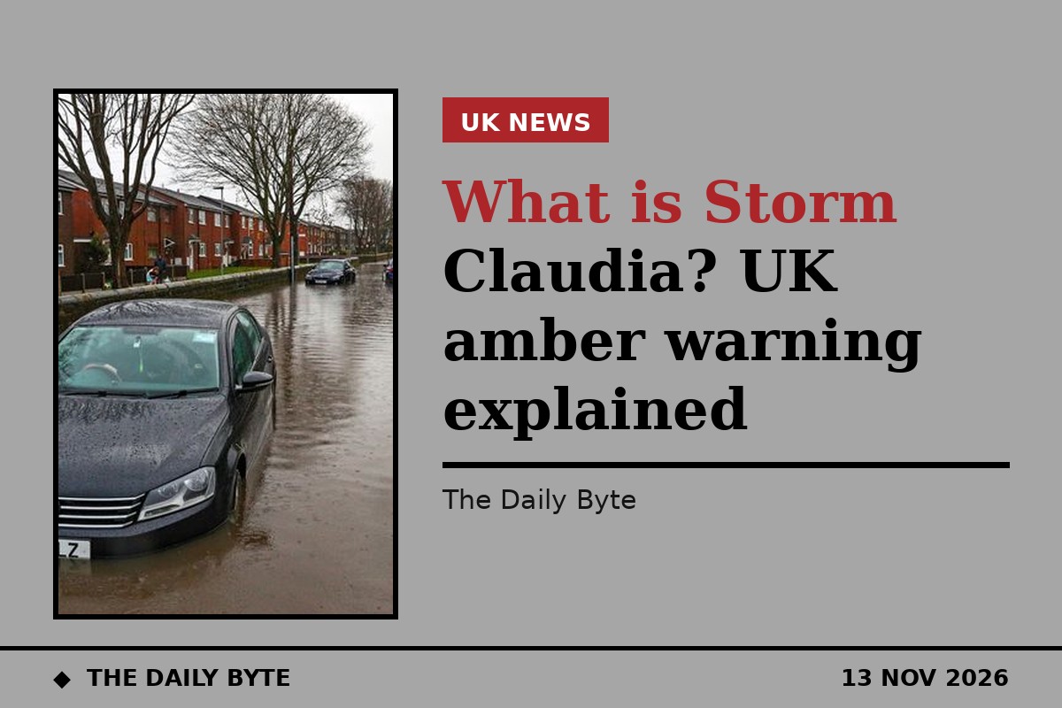
Storm Claudia is bringing heavy rain and strong winds to England and Wales, with the Met Office issuing amber warnings for rain across central parts of both countries on Friday 13 November. The storm was named by Spain's weather service, AEMET, after it first brought heavy rain to the Canary Islands and the Iberian Peninsula, and it is now stalling over the UK instead of sweeping quickly across it.
Amber is the second-highest level in the Met Office's warning system. It means severe weather is likely and people should be prepared for disruption, including flooding, difficult driving conditions and possible power cuts. The warnings cover rain on Friday, with the heaviest falls expected on east-facing higher ground.
Where will Storm Claudia hit hardest?
The amber warnings cover central parts of England and Wales. The Met Office said 50 to 150 millimetres of rain could fall in some areas, with the highest totals on higher ground in south-east Wales, where 100 to 150 millimetres is possible. A yellow warning for rain is also in effect across central and southern England, and two yellow wind warnings cover north-west Wales, north-west England and the West Midlands.
Met Office meteorologist Alex Burkill said the wind direction was pivotal: winds coming in more from the east would push the heaviest rain onto east-facing hills, particularly in south-east Wales, where some flooding and major disruption is quite likely. More than 100 flood alerts were active across England, mainly in the Midlands, according to Weather and Radar.
Gusts of 60 to 70mph are expected in exposed areas, particularly in north-west Wales and along western coasts, with winds of 35 to 50mph more widely. The far south may see milder conditions and brighter spells later in the day, but heavy showers remain possible. The Met Office said the rain would slowly ease overnight, with winds moderating, and that sheltered inland areas could see patchy frost as colder air seeps further south.
Why is Storm Claudia different?
Most Atlantic storms cross the UK in a matter of hours. Claudia is different because it is barely moving. Its rain bands are sitting almost stationary over central and southern England and Wales throughout Friday, only easing well into Saturday.
That slow movement is what makes the rainfall totals so high: the same areas keep getting rained on for hour after hour. In some places, a month's worth of rain, typically 75 to 100 millimetres in November, could fall in under 24 hours. The storm is also unusual in its origins: it formed around the Mediterranean rather than in the North Atlantic, and it was named by Spain rather than by the UK, Ireland and Netherlands storm-naming group, because it affected Spain and Portugal first. It delivered up to 200 millimetres of rain in Portugal and western Spain before reaching the UK.
What about the rest of the UK?
Friday brings a sharp contrast across the country. Much of Scotland, Northern Ireland and far northern England will stay dry and cold, with sunny spells and scattered showers that could turn wintry over hills and in Shetland. Temperatures will be in single figures Celsius as far south as the Midlands, while the far south stays milder.
On Saturday, the north-south split continues. Scotland will be largely dry with sunny spells, especially in the west, while England, Wales and possibly Northern Ireland stay overcast and wet, with heavier overnight rain easing but light rain and drizzle persisting. The rain from Claudia continues into Saturday but is expected to fizzle out as the weekend goes on.
What should people do?
People in amber warning areas should expect flooding and disruption to travel, with road closures and delays to trains likely. The Met Office advises checking its warnings before travelling and allowing extra time for journeys.
Drivers should never attempt to drive through floodwater, which is often deeper than it looks, and pedestrians should avoid walking through flooded streets. People should check flood alerts for their area and keep up to date with the forecast, as the Environment Agency, local councils and emergency services will publish updates if conditions worsen.
Claudia is the latest in a run of wet weather for the UK, and with soils already waterlogged in many areas, the ground has little capacity to absorb more rain, which is one reason the Met Office expects flooding even though the rain is falling over a single day rather than a week.
How long will Storm Claudia last?
The worst of the rain falls on Friday and into Friday night. By Saturday the rain eases, and by Sunday the storm is expected to have fizzled out, with the south starting overcast with pockets of drizzle and hill fog before conditions improve. The Met Office will update its warnings as the storm moves, so the latest forecast is the one to follow.