What Is a Cyclone? Explained
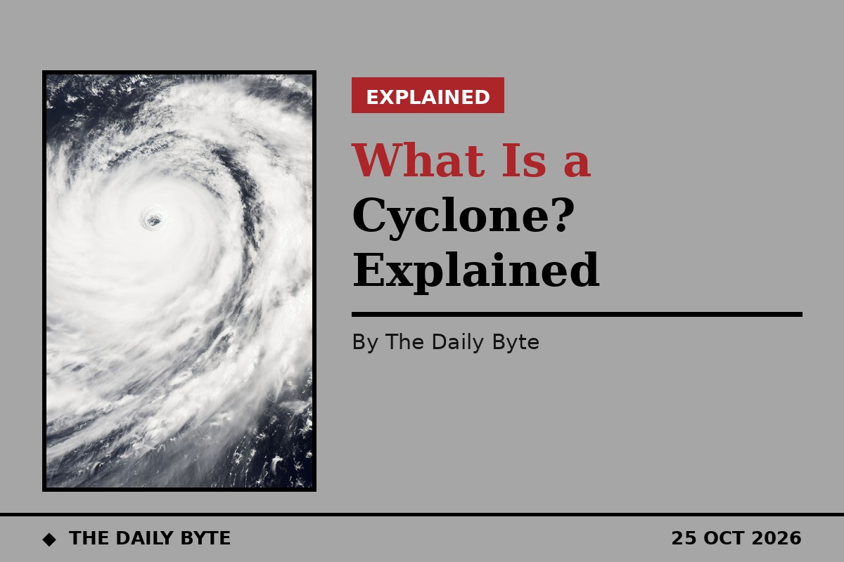
A cyclone is a large, rotating tropical storm that forms over warm ocean water, with a low-pressure centre, strong winds and spiral bands of thunderstorms that bring heavy rain. The same kind of storm is called a hurricane in the North Atlantic and the eastern Pacific, and a typhoon in the north-west Pacific. The only difference between a hurricane and a typhoon is where the storm occurs, in the words of the United States National Oceanic and Atmospheric Administration (NOAA): the storm itself, how it forms and what it can do are the same. In the Indian Ocean and the South Pacific, the name used is cyclone.
The question matters right now because a depression in the Bay of Bengal is strengthening towards India's east coast. The India Meteorological Department (IMD) said on 15 November 2026 that the system, about 780 kilometres east-south-east of Chennai at 5.30 pm, was expected to become a cyclonic storm on the evening of 16 November — at which point it would be named Akvan — then a severe cyclonic storm on the evening of 17 November, and a very severe cyclonic storm with winds of 120 to 130 kilometres per hour, gusting to 145, by the evening of 19 November. A pre-cyclone watch was in place for the Andhra Pradesh and south Odisha coasts. This explainer answers what a cyclone is, how one forms, how it is measured, and how it gets its name.
How does a cyclone form?
A tropical cyclone is a heat engine powered by the sea. It begins as a cluster of thunderstorms over warm tropical water. Warm, moist air rises from the ocean surface, cools as it climbs, and condenses into cloud and rain, releasing heat that warms the air around it and makes it rise faster. More air rushes in at the surface to replace it, and the Earth's rotation deflects that inflowing air, setting the whole system turning. As the spin tightens, a calm, clear eye forms at the centre, ringed by the eyewall, where the strongest winds and heaviest rain are found.
Five ingredients have to be present. First, the sea surface must be warm — around 26.5 to 27 degrees Celsius — and the warm water must be deep enough that mixing does not bring cold water to the surface. Second, the atmosphere must be unstable enough for thunderstorms to keep developing. Third, the middle levels of the atmosphere must be humid, so rising air does not dry out. Fourth, there must be little vertical wind shear, meaning the wind does not change much with height; strong shear tears a developing storm apart. Fifth, there must be enough Coriolis force — the apparent force from the Earth's rotation — to get the air turning. That is why cyclones almost never form within about five degrees of the equator, where the Coriolis force is too weak, and why they form mainly between 5 and 20 degrees of latitude, north and south.
A cyclone also needs a starting disturbance, such as a low-pressure area or a cluster of thunderstorms, to organise around. Without one, the ingredients alone do not produce a storm. Once organised, the system feeds on the ocean's heat and moisture until it moves over land or colder water, which cuts off its energy supply, and it weakens and dissipates.
Why is the same storm called a hurricane, a typhoon or a cyclone?
The generic term is tropical cyclone, and the everyday name depends on the ocean. Over the North Atlantic and the central and eastern North Pacific, a strong tropical cyclone is a hurricane. Over the north-west Pacific, it is a typhoon. Over the Indian Ocean and the South Pacific, it is a cyclone. Below hurricane strength, the Atlantic system uses the terms tropical depression and tropical storm; in the North Indian Ocean, the IMD uses its own ladder of terms, from low-pressure area up to super cyclonic storm.
Two things are the same everywhere. In the northern hemisphere every tropical cyclone turns anticlockwise, seen from above, and in the southern hemisphere every one turns clockwise. And the name is set by location, not by strength: a typhoon that crossed into the central Pacific would be reclassified as a hurricane, even though nothing about the storm itself had changed.
The word cyclone itself was coined in Kolkata by Henry Piddington, who worked there during British rule, from the Greek word for the coil of a snake. The World Meteorological Organization divides responsibility for tracking these storms between six Regional Specialised Meteorological Centres. For the Bay of Bengal and the Arabian Sea, that centre is the IMD in New Delhi, which serves a panel of 13 countries.
The eye, the eyewall and the rainbands
A mature cyclone has three parts. At the centre is the eye, a roughly circular area of calm air, sometimes clear enough to see the sea or the ground below, where air sinks gently instead of rising. Around it is the eyewall, a ring of towering thunderstorms where the winds are strongest and the rain is heaviest. Beyond that, spiral rainbands wrap around the storm, bringing bands of heavy rain and gusty wind that can stretch hundreds of kilometres from the centre. The whole system is typically 200 to 500 kilometres across, though it can reach 1,000 kilometres, according to the World Meteorological Organization's definition.
The eye is also why a cyclone can mislead people on the ground. When the eye passes overhead, the wind drops and the rain stops, and it can feel as if the storm is over. It is not: the eyewall follows, with winds from the opposite direction, often just as strong as before. That is one reason official warnings tell people to stay indoors until the storm has fully passed.
How strong is it? The IMD scale
In the North Indian Ocean, the IMD classifies a system by its maximum sustained surface wind speed, averaged over three minutes. There are eight steps, from weakest to strongest. A low-pressure area has winds below 31 kilometres per hour. A depression has winds of 31 to 49 kilometres per hour, and a deep depression 50 to 61. At 62 kilometres per hour the system becomes a cyclonic storm, and that is the point at which it is given a name. A severe cyclonic storm has winds of 89 to 117 kilometres per hour, a very severe cyclonic storm 118 to 166, an extremely severe cyclonic storm 167 to 221, and a super cyclonic storm 222 kilometres per hour and above.
Each step is tied to the damage the IMD expects and to the action officials should take. A depression brings minor damage to loose and unsecured structures, and fishermen are told not to go to sea. A cyclonic storm damages thatched huts and breaks branches, and all fishing stops. A severe cyclonic storm brings extensive damage to thatched roofs, brings down large roadside trees and floods escape routes, and coastal hut dwellers are moved to safer places. A very severe cyclonic storm brings extensive damage to weaker houses, partial loss of power and phone lines, danger from flying debris and flooded escape routes, and evacuation from coastal areas. An extremely severe cyclonic storm brings large-scale loss of power and phone lines and disrupts rail and road traffic, with extensive evacuation. A super cyclonic storm brings extensive damage to homes and industrial buildings, total loss of power and phones, damage to bridges, sea water flooding inland, and large-scale evacuation.
The forecast for the developing system in the Bay of Bengal puts it on the middle rungs of that ladder: a cyclonic storm on 16 November, a severe cyclonic storm on 17 November, and a very severe cyclonic storm, with winds of 120 to 130 kilometres per hour gusting to 145, by 19 November. The IMD has not given a landfall place or time, and the forecast is a forecast, not an event: intensity and track forecasts for a developing storm can change with each bulletin.
How does that compare with the Saffir-Simpson scale?
For Atlantic and eastern Pacific hurricanes, the scale most readers will have heard of is the Saffir-Simpson Hurricane Wind Scale, published by the United States National Hurricane Center. It rates a hurricane from Category 1 to Category 5 on maximum sustained wind speed alone: Category 1 is 119 to 153 kilometres per hour, Category 2 is 154 to 177, Category 3 is 178 to 208, Category 4 is 209 to 251, and Category 5 is 252 kilometres per hour or higher. Category 3 and above are called major hurricanes. The centre stresses that the scale estimates wind damage only and does not take into account storm surge, rainfall flooding or tornadoes, all of which can kill even in a lower-category storm.
The two scales are not directly interchangeable, because the IMD averages wind over three minutes while United States agencies use a one-minute average, and because the IMD scale has more steps at the lower end. Roughly, a very severe cyclonic storm, at 118 to 166 kilometres per hour, spans the range of a Category 1 hurricane and the lower part of Category 2. But wind speed alone never tells the whole story: the IMD notes that its category describes wind only, and that surge height, rainfall and inland flooding frequently determine the actual impact.
How do cyclones get their names?
A North Indian Ocean system is named only when it reaches cyclonic storm strength, at 62 kilometres per hour. The names come from a fixed, rotating list agreed by the countries of the region, and each country contributes names in turn. After Arnab and Murasu, the next name on the list is Akvan, contributed by Iran. That is why reports on 15 November 2026 called the developing Bay of Bengal system the likely Cyclone Akvan, even though the IMD had not formally named it yet: the name is applied when the system becomes a cyclonic storm, which the IMD expected on the evening of 16 November.
Naming serves a practical purpose. A short, distinctive name is easier to remember and to use in warnings than a string of coordinates or a technical classification, and it reduces confusion when more than one storm is active at the same time. The same system is used in other ocean basins, with each region keeping its own list.
What damage does a cyclone do?
Wind is the most visible danger, tearing roofs, bringing down trees and power lines, and turning loose objects into debris. But in most cyclones the deadliest hazards are water. The storm surge — sea water pushed ashore by the wind and the low pressure — can flood coastal land metres deep. Heavy rain can fall for hours or days, flooding rivers and towns far inland, long after the wind has eased. The National Hurricane Center notes that hurricanes of all categories can produce deadly storm surge, rain-induced floods and tornadoes, and that these hazards require protective action, including evacuation from areas vulnerable to storm surge.
For the system now forming in the Bay of Bengal, the IMD's forecast already points to water as the main threat: isolated extremely heavy rain, of 21 centimetres or more, over north coastal Andhra Pradesh on 19 and 20 November, heavy to very heavy rain in Odisha from 19 to 21 November, and heavy rain in north Tamil Nadu from 17 November. Fishermen have been advised not to venture into the affected sea areas. Anyone in the region should follow the IMD's bulletins and the instructions of local authorities, which are updated as the forecast changes.
Frequently asked questions
Is a cyclone the same as a hurricane? Yes. A cyclone, a hurricane and a typhoon are the same kind of storm — a tropical cyclone. The name depends on the ocean: hurricane in the North Atlantic and eastern Pacific, typhoon in the north-west Pacific, and cyclone in the Indian Ocean and South Pacific.
What is the difference between a cyclone and a tornado? A cyclone is a huge tropical storm, hundreds of kilometres across, that forms over warm seas and lasts for days. A tornado is a narrow, violently rotating column of air, usually less than a kilometre wide, that forms over land from a thunderstorm and lasts for minutes. A cyclone can produce tornadoes, but the two are different phenomena.
When does a storm get a name? In the North Indian Ocean, when it reaches cyclonic storm strength, with sustained winds of 62 kilometres per hour. The name comes from a fixed rotating list; the next name after Arnab and Murasu is Akvan.
Does a higher category always mean more deaths? No. The scales rate wind speed only. Storm surge, rainfall and flooding often cause more deaths than wind, and a slow-moving, rain-heavy storm can be more destructive than a faster, windier one. That is why warnings cover rain and surge as well as wind.
Source: NOAA / National Hurricane Center — Saffir-Simpson Hurricane Wind Scale. IMD classifications, warning stages and the Akvan forecast are from India Meteorological Department bulletins of 15 November 2026, as reported on 15 November 2026. Figures were checked on 15 November 2026.