What Is a Seismic Survey? Explained
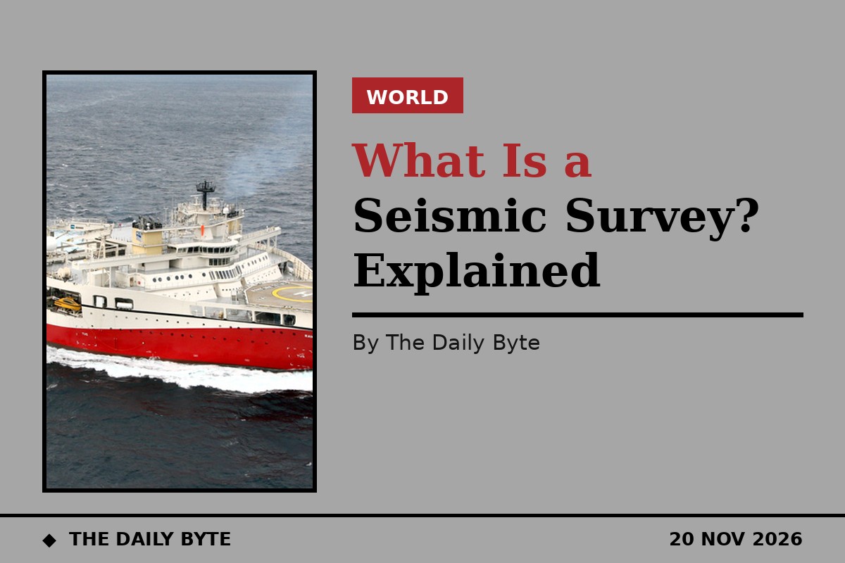
On 20 November 2026, a specialist survey ship called the Ramform Tethys arrived in the southern Ionian Sea to begin seismic surveys for oil and gas on behalf of the Chevron-HELLENiQ ENERGY consortium. The work, announced by Greece's Environment and Energy Minister Stavros Papastavrou, will map the seabed south of the Peloponnese and is expected to finish by the end of January 2027. But what is a seismic survey, how does a ship map rock buried miles beneath the sea, and what can the results actually prove? This explainer answers those questions.
In short, a seismic survey is a way of seeing underground without drilling. A sound source sends waves down into the Earth, the waves bounce back from the boundaries between different rock layers, and receivers record the echoes. Computers turn millions of those echoes into images of the subsurface, showing folds, faults and rock formations that could trap oil or gas. The technique cannot prove that oil or gas is present. Only a drilled well can do that. What it can do is show where drilling is most likely to succeed, and where it would be a waste of money.
What is a seismic survey?
A seismic survey is a method of investigating the structure beneath the Earth's surface, particularly in the search for petroleum, natural gas and mineral deposits. The technique is based on measuring the time between a seismic wave being set off at a chosen point and the arrival of its reflected or refracted echoes at detectors placed nearby. The timing and strength of those echoes reveal the depth and shape of the rock layers the waves passed through.
The idea is similar to an echo sounder, or to a bat navigating in the dark. A pulse of energy goes out, it bounces off something, and the return tells you how far away that something is and what it is made of. The difference is scale. A seismic survey maps structures kilometres below the surface, across areas that can stretch for thousands of square kilometres, and it does so by recording waves that have travelled through rock, salt, sand and water.
Seismic surveying is the most important geophysical exploration method in the oil and gas industry, because it can detect features on scales from the very large to the relatively small, and because it works before a single well is drilled. Early oil prospectors found oil by drilling visible seeps and folds in exposed rock. Once the easy targets were gone, geologists turned to seismic surveys to find traps hidden underground. The first oil field discovered with seismic data was in Texas in 1924.
How does a seismic survey work, step by step?
Every survey follows the same basic sequence, whether it is run on land or at sea. First comes design. Geologists decide what depth and size of target they are looking for, and engineers plan the geometry of the survey: where the sound sources will be, where the receivers will sit, and how closely spaced the lines of data should be. A two-dimensional survey records a single line of data, like a cross-section through the Earth. A three-dimensional survey records a dense grid, producing a full volume of data. A four-dimensional survey repeats a 3D survey over time, to watch fluids move while a field is producing.
Second comes acquisition, the actual fieldwork. A sound source sends pulses into the ground, and receivers record the echoes. On land, the receivers are geophones, small sensors pressed into the ground that detect vibrations. At sea, they are hydrophones, towed behind a ship in long cables called streamers. The ship sails in a precise grid pattern, firing its source at regular intervals, while the streamers record continuously.
Third comes processing. Raw seismic data is noisy, full of echoes from the surface, from the sea, and from layers that are not of interest. Computers clean it up, correct for the speed of sound in different rocks, and stack the millions of individual recordings into coherent images. Fourth comes interpretation. Geophysicists read those images, mapping anticlines, the arch-shaped folds that can trap hydrocarbons, faults, salt bodies and other structures, and they use the brightness and character of the reflections to guess at rock types and fluids. Direct hydrocarbon indicators, such as bright spots and flat spots in the data, can hint at gas, but they are clues, not proof.
What happens at sea?
Offshore, the sound source is almost always an air gun, an array of chambers towed behind the ship that releases a sharp pulse of compressed air into the water. The Ramform Tethys, the vessel now working off Greece, is one of the most specialised ships of its kind. It is a wide, flat-sterned vessel designed to tow many streamers at once, spreading them across a broad swath of sea so that each pass of the ship records a wide band of data. Its name was visible on the stern in the photograph used with this article.
The Greek programme shows how a marine survey is organised. The surveys are being carried out by TGS, an energy data company, for the Chevron-HELLENiQ ENERGY consortium, in the concession areas the consortium holds off southern Greece. The Ramform Tethys is accompanied by a support vessel, Thor Freyja, and an escort vessel, EDT Niovi, and the three ships were the subject of a Hellenic Coast Guard document seeking an exemption for their use from 20 November 2026 to 31 January 2027. A maritime notice, known as a NAVTEX, was approved so that other shipping would know the survey was under way. The work covers the offshore blocks known as A2 and South of the Peloponnese, and reports put the overall mapping area at about 47,000 square kilometres. Surveys south of Crete, in the South Crete 1 and South Crete 2 blocks, are described as a later phase in 2027.
In a separate process, three of the world's largest companies in the sector, SLB, Viridien and BGP, have bid for a tender run by the Hellenic Hydrocarbons and Energy Resources Management Company to collect and process non-exclusive seismic data off western and southern Greece. The evaluation committee met on 19 November to open the bids.
What happens on land?
On land, the principles are the same but the equipment is different. The most common source today is the vibroseis truck, a heavy vehicle that lowers a vibrating plate onto the ground and shakes it for several seconds, sending a controlled sweep of frequencies into the Earth. It is more precise than an explosion, because the vibration is spread over time and can be tuned. Dynamite is still used in some places, set off in shallow holes drilled for the purpose, and falling weights known as thumpers are used where an explosion might cause damage, for example near caverns.
Receivers on land are laid out in lines across the survey area, sometimes thousands of them, connected by cable or operating as standalone nodes that record independently and are collected afterwards. Survey crews use satellite positioning to place every source and receiver precisely, because the whole method depends on knowing exactly where each pulse started and where each echo arrived. On land, access to the ground, weather, terrain and the presence of towns and farms all shape the survey, in ways that do not apply at sea.
What can a seismic survey actually find?
This is the question most often misunderstood. A seismic survey cannot identify pools of oil or gas. As the US Bureau of Land Management has explained, the data shows the tops and bottoms of formations, their thickness and their structural configuration, and from that, conditions favourable for the possible accumulation of oil and gas. It shows geometry, not contents.
What it can find is structure. It can map a fold that could trap hydrocarbons, a fault that seals a reservoir, a salt dome that has pushed surrounding rock into a trap, or a layer of porous sandstone buried beneath an impermeable cap rock. Combined with knowledge of the local geology, that structure is enough to rank prospects and to choose where to drill. The only way to prove that hydrocarbons are present is to drill a well, which is why exploration is expensive: a survey reduces the risk, but it does not remove it.
Surveys have other uses beyond finding oil. They map faults for earthquake studies, they check the ground before tunnels and offshore wind farms are built, they monitor carbon storage sites, and they help geologists understand the deep structure of the Earth. The same technology that hunts for gas also produces the images used to store carbon dioxide underground safely.
Why do seismic surveys attract debate?
Offshore surveys operate under permits, maritime notices and environmental rules, and that regulatory layer is part of the story in Greece, where a Coast Guard document, a NAVTEX approval and a tender process all preceded the first pulse. The sound pulses themselves are the focus of the debate. Air guns are loud by design, because the sound has to travel kilometres through rock and return, and the question of how that sound affects marine life, particularly whales and other cetaceans that navigate by hearing, is contested between the industry, which points to mitigation measures such as gradual ramp-up and marine mammal observers, and environmental groups, which argue the effects are under-studied.
On land, the concerns are different: access to private ground, vibration near buildings, and the disruption of laying out thousands of receivers across farmland. In both settings, the survey is only the first step. If the data looks promising, the consortium must still decide whether to drill an exploration well, which requires further permits, environmental review and investment, and which carries its own debate.
What happens after the survey?
Once acquisition ends, the data is processed and interpreted, a job that takes months. Geophysicists build a picture of the subsurface, rank the prospects, and estimate the chance of success for each. If a prospect looks strong, the consortium may apply to drill an exploration well. If the data is disappointing, the block may be dropped, or the data may be licensed to others.
For Greece, the timeline is public. The first phase of surveys runs to the end of January 2027, and the Crete blocks are a later phase. Whether anything is found will not be known until the data is processed, and even a promising result would be years away from production. That slow pace is normal for offshore exploration. The survey is the beginning of a long process, not the discovery itself, and its real value is information: a map of what lies beneath the sea, where before there was only a guess.