What Is a Super Typhoon? Fung-wong Explained
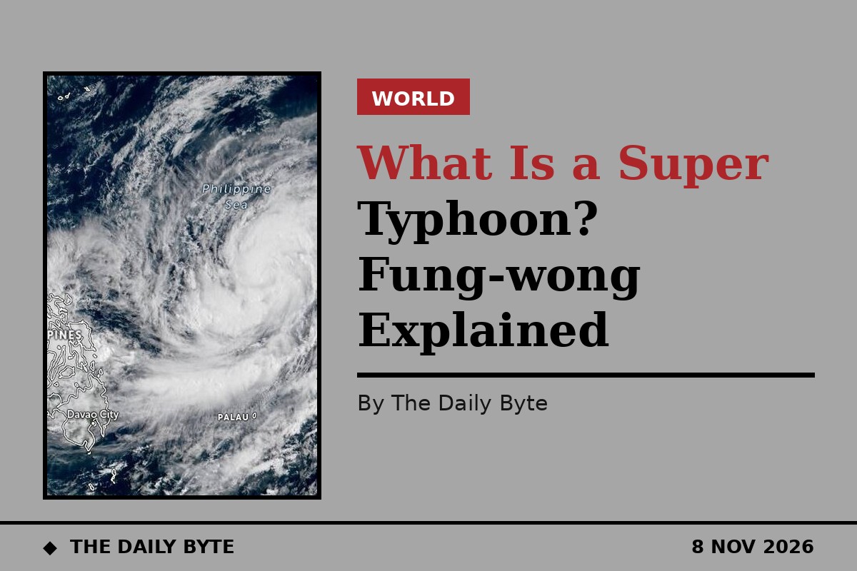
Super Typhoon Fung-wong, known in the Philippines as Uwan, slammed into the eastern coast of Luzon on Sunday night, making landfall at Dinalungan in Aurora province with sustained winds of 185 kilometres per hour and gusts of up to 230 kilometres per hour, according to the state weather bureau PAGASA. More than a million people had been moved to safety before the storm arrived, and officials later counted more than 1.2 million people displaced across Luzon. The storm was the 21st tropical cyclone to reach the Philippines this year. But what does the label super typhoon actually mean, and why did this storm trigger one of the largest evacuations the country has ever attempted? The Associated Press reports that Fung-wong may have been the biggest typhoon to threaten the Philippines in years.
What super typhoon means
A super typhoon is not a separate kind of storm. It is the top category in the classification used by PAGASA, the Philippine Atmospheric, Geophysical and Astronomical Services Administration. In the Philippines, a tropical cyclone with sustained winds of 185 kilometres per hour or higher is categorised as a super typhoon, a designation adopted years ago to underline the urgency attached to the most extreme storms. The same kind of storm is called a hurricane in the Atlantic and a cyclone in the Indian Ocean; the name changes with the ocean, not with the physics.
The label is about wind speed, but wind is only part of the danger. A storm of this size also brings torrential rain, storm surges that push seawater far inland, and landslides on soaked mountain slopes. Fung-wong's rain and wind band was more than 1,600 kilometres wide, wide enough to cover two-thirds of the Philippine archipelago, according to forecasters. That scale is why warnings covered so much of the country at once, and why the evacuation was measured in millions rather than thousands.
The warning signals
PAGASA warns the public through a system of tropical cyclone wind signals, numbered from one to five. Signal No. 5 is the highest level, reserved for the most violent winds. As Fung-wong approached, Signal No. 5 was in force over northern and central Aurora, southern Quirino, southeastern Nueva Vizcaya and northeastern Nueva Ecija, while Signal No. 3 covered Metro Manila and nearby provinces. The signals are raised area by area as the storm approaches, so that people in the path know how severe the wind threat is where they live, rather than relying on a single national warning.
Alongside the wind signals, PAGASA and the disaster authorities warned of a high risk of life-threatening storm surge of more than three metres along the coasts of more than 20 provinces and regions, including metropolitan Manila. Coastal towns took the first blow as the storm came ashore, with roofs torn from houses and trees and power poles brought down. In Isabela province, the cities of Santiago and Cauayan reported damaged homes and roads blocked by debris, and provincial officials said some upland and coastal communities had been cut off by landslides.
Why the evacuation was so large
More than 916,860 people were evacuated from high-risk villages before landfall, and the national disaster council later said the pre-emptive evacuation had reached about 1.4 million people. The Office of Civil Defense said more than 30 million people could be exposed to the hazards posed by the storm. Schools and most government offices in the northern provinces were shut for Monday and Tuesday, more than 300 domestic and international flights were cancelled, and coastguard teams helped residents move from boats to waiting trucks in pre-emptive evacuations in Camarines Sur.
There was a grim reason for the scale of the operation. Fung-wong arrived only days after Typhoon Kalmaegi had torn through the central Philippines, killing at least 224 people there before moving on to Vietnam, where at least five more were killed. President Ferdinand Marcos Jr had already declared a state of emergency because of the devastation caused by Kalmaegi and the calamity expected from Fung-wong. Defence Secretary Gilbert Teodoro Jr, who oversees the disaster response agencies and the military, warned in televised remarks of the storm's potentially catastrophic effect.
What happened on land
Fung-wong made landfall at Dinalungan at 9:10 p.m. on Sunday, then tracked across the mountain ranges of northern Luzon, weakening over land but remaining a dangerous storm. Officials reported at least two deaths as it crossed the island: one person drowned in Catanduanes, and a woman in Catbalogan City in Samar was struck by debris after returning to her house to fetch belongings. Police and local officials reported three further deaths that were still awaiting validation, so the toll may rise as reports come in from cut-off communities.
The national disaster council said the storm affected 1,198,039 people from 330,792 families in 11 regions. By the time it was last tracked 175 kilometres west of Sinait in Ilocos Sur, Fung-wong had weakened into a typhoon with winds of 120 kilometres per hour and gusts of 150 kilometres per hour. Forecasters expected it to leave Philippine waters by Tuesday morning, with a chance it could return later in the week as it approached the southwestern coast of Taiwan, where preparations were already under way.
Why the Philippines is so exposed
The Philippines sits in the western Pacific, the most active tropical cyclone basin in the world, and storms forming over the warm ocean to the east usually meet the archipelago first. That geography means the country faces a long procession of storms every year, and Fung-wong was the 21st tropical cyclone to reach it this year. Warm Pacific waters feed these storms, and the archipelago's long coastlines, steep mountains and densely populated river valleys turn wind and rain into flooding, landslides and storm surge.
That is also why evacuation, rather than riding the storm out, has become the centrepiece of the Philippine response. Moving more than a million people before landfall is an enormous operation, but the disaster council credited it with keeping the death toll low this time. The comparison with Kalmaegi, which killed more than 200 people only days earlier, shows the stakes: when a super typhoon arrives on top of a country still clearing up from the last one, the margin for error is almost none.