What Is Frost? How It Forms on Cold Nights
The United Kingdom woke on Saturday 21 November 2026 to a cold and frosty start. The Met Office forecast a dry day with plenty of sunshine, temperatures below the November average, and a cold overnight with widespread frost. It is the kind of morning that turns lawns white, ices car windscreens and leaves footprints on the grass, and it raises a simple question that many people ask each winter: what exactly is frost, and how does it form on a night when it has not rained or snowed at all?
Frost is ice, but it is not frozen rain and it is not snow. It is water vapour from the air turning directly into ice crystals on a cold surface. No cloud is needed, and no precipitation has to fall. All it takes is a surface that cools below freezing, enough moisture in the air, and a still, clear night. The Met Office expects those conditions across much of the UK tonight, with frost widespread and a few wintry showers over the hills of north-east England and eastern Scotland.
What is frost?
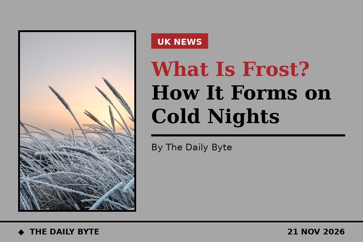
Frost is a thin layer of ice crystals that forms on a surface when the temperature of that surface falls to or below freezing point and water vapour in the air deposits onto it as ice. The key point is that the water skips the liquid stage. Instead of condensing into droplets and then freezing, the vapour turns straight into solid crystals, a process scientists call deposition. The result is the white, feathery coating you see on grass, rooftops, car roofs and fences on a cold morning.
Frost is not the same as snow. Snow forms high in the atmosphere when water vapour freezes around tiny particles in a cloud and falls to the ground as flakes. Frost forms on the ground, on surfaces that have cooled below freezing. It is also not the same as frozen dew. Dew is liquid water that condenses on a surface when the air cools to its dew point. If the temperature then drops below freezing, that dew can freeze, but true frost never passes through the liquid stage at all.
How frost forms
Frost forms by radiative cooling. After sunset, the ground and the objects sitting on it lose heat by radiating it away into the sky. On a cloudy night, the cloud acts like a blanket, sending some of that heat back down, so surfaces stay warmer. On a clear night, there is nothing to send the heat back, and surfaces can cool several degrees below the temperature of the air around them. That is why the coldest, frostiest nights are usually the clearest and calmest ones.
Two other ingredients matter. The first is moisture. Air always holds some water vapour, even in winter, and frost can only form if there is enough of it to deposit as ice. Very dry air produces little or no frost even when it is bitterly cold. The second is still air. Wind mixes warmer air down from above and stops surfaces from cooling to freezing point, which is why frost is rarest on windy nights. A clear sky, light winds and a long night are the classic recipe, and that is exactly the pattern the Met Office describes for tonight.
The temperature at which frost forms is linked to the dew point, the temperature to which air must cool before water vapour starts to condense. When the dew point is below freezing, it is sometimes called the frost point. If a surface cools below the frost point, vapour deposits on it as ice. If the surface is only just below freezing, the frost will be light. On a long, clear night with moist air, it can build into a thick white coat.
Ground frost and air frost
Weather forecasters distinguish between ground frost and air frost, and the difference matters for gardeners. Air frost is measured in the standard way, with the air temperature at about 1.2 metres above the ground falling below zero. Ground frost is measured at the surface itself, and it can happen even when the air temperature a metre up is still above freezing, because the ground cools faster than the air. That is why your lawn can be white with frost on a morning when the forecast says the overnight low was only 1C or 2C.
Ground frost is the more common of the two in the UK. It appears first on low-lying ground, where cold air pools, and on exposed surfaces such as grass, car roofs and garden furniture. Air frost is less common and more serious for plants, because it means the air itself, not just the ground, is below freezing. A forecast that mentions frost usually means ground frost unless it says otherwise.
The different types of frost
Not all frost looks the same. Hoar frost is the classic kind: large, feathery white crystals that grow on grass, branches and fences on cold, still nights with moist air. It is the frost of Christmas cards and winter photographs, and it forms when water vapour deposits slowly onto a surface that is well below freezing. White frost is a thinner, more general coating, the kind that turns a lawn pale and makes a windscreen opaque.
Rime is a different beast. It forms when tiny supercooled water droplets in fog or low cloud freeze on contact with a cold surface, building up a rough, white crust, often on the windward side of trees, fences and wires. Rime needs fog or mist, so it is common on hills and in valleys where fog lingers. There is also black frost, which is not frost at all in the visible sense: it is the damage done to plants when a hard freeze kills the tissue without leaving a white coating, so the leaves turn black. Gardeners dread it because it arrives without the warning sign of a white lawn.
Why frost appears on some surfaces first
Frost does not coat everything equally, and the pattern tells you how it works. Metal car roofs, glass windscreens and flat rooftops frost first, because they lose heat quickly by radiation and have little warmth stored in them. Grass frosts readily for the same reason: each blade is thin, exposed to the sky and quick to cool. Stone walls and soil cool more slowly, so they frost later or not at all.
Position matters too. Frost is heaviest in hollows and valley bottoms, where cold, dense air drains downhill and pools overnight. It is lighter on hilltops and slopes, where the cold air drains away. A car parked under a tree or in a garage may stay frost-free while one parked in the open is coated, because the tree or the roof blocks the open sky and cuts the radiative cooling. That is also why a blanket thrown over tender plants works: it is not the warmth of the blanket that protects them, but the fact that it stops them radiating heat to the clear sky.
Frost, fog and snow: how they differ
Frost is often confused with its winter cousins, but each forms in a different way. Fog is a cloud at ground level, made of tiny liquid water droplets suspended in the air. It forms when moist air cools to its dew point, and it can reduce visibility to a few metres. Frost is ice on a surface, not droplets in the air. Snow is ice that forms in a cloud and falls. Freezing fog is the link between them: fog droplets that are supercooled can freeze on contact with surfaces, producing rime.
The three can appear together. A cold, clear night can produce frost, and as the temperature falls further, fog can form in the valleys by morning. If a weather front then moves in, as the Met Office expects in the south-west tonight, with rain arriving later, the frost will melt as cloud cover increases and temperatures rise. Rain on a frosty surface can also freeze on contact, producing ice, which is one reason forecasters warn drivers to take care when a thaw follows a frost.
What the forecast says for this weekend
The Met Office forecast for Saturday 21 November 2026 describes a cold and frosty start, then a dry day with plenty of sunshine. Any showers in the far north will ease, though it will become breezier across western and south-western areas later. Temperatures are below the November average, ranging from around 3C in the north to 13C in the south-west, according to the Weather Outlook. Tonight will be cold overnight with widespread frost. Cloud will build in north-east England and eastern Scotland with a few showers, wintry over hills, while wind and cloud increase in the south-west and rain arrives later.
Sunday is mostly dry across central and northern areas with sunny spells, while rain spreads into the south-west with strengthening winds. Temperatures will be near normal, though rather cold for the north and west. In other words, the frost is a one-night story for most of the country: a clear, calm, cold night, followed by cloud and rain moving in from the south-west. Anyone planning an early start on Sunday should still expect icy windscreens in the north and centre, where the skies stay clearest longest.
Frost and driving
Frost is a familiar hazard for drivers, and it is worth treating it with respect. A frosted windscreen must be fully cleared before driving, not just a small peephole scraped in the middle. De-icer or lukewarm water will clear the ice; boiling water should never be poured on a frozen windscreen, because the sudden change in temperature can crack the glass. Windscreen wipers should be lifted or switched off before they freeze to the glass, and drivers should allow extra time on frosty mornings rather than rushing the job.
Roads can be icy even where there is no visible frost. Bridges and exposed stretches cool fastest and freeze first, and a road that looks merely damp may be covered in black ice, a thin, transparent layer that is almost invisible. The advice is the same every winter: slow down, increase the gap to the vehicle in front, brake gently, and avoid sudden steering. If the car has been standing in the open overnight, check the roof and the mirrors as well as the windscreen, since falling ice from a roof can be a hazard to other road users.
Frost in the garden
For gardeners, the first frosts of the season are a signal to act. Tender plants such as dahlias, fuchsias and pelargoniums can be killed by a single sharp frost, so they should be lifted, moved under cover or protected with fleece before the first cold night. Pots can crack if the compost inside them freezes and expands, so terracotta pots are best moved to a sheltered spot or wrapped. Standing water in bird baths and containers should be broken or emptied so it does not freeze solid.
Not all frost is bad news for a garden. A cold spell can kill off pests and diseases, and some plants, including many fruit trees, need a period of cold to flower and fruit properly the following year. Frost can also improve the flavour of some winter vegetables, such as parsnips and Brussels sprouts, by turning their starches into sugars. The trick is knowing which plants are hardy and which are not, and acting before the first frost rather than after it.
As the Met Office forecast shows, frost is a normal part of a British November. It needs no storm and no snowfall, just a clear sky, still air and a surface cold enough for water vapour to turn to ice. Tonight has all three, which is why so many lawns and windscreens will be white by morning.