WMO El Niño 2026 reaches very strong category
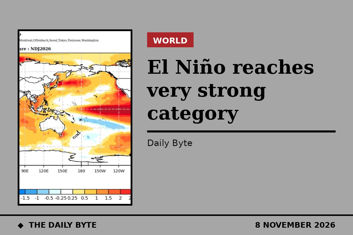
The El Niño event of 2026 has officially reached the “very strong” category, according to the operational criteria of the United States National Oceanic and Atmospheric Administration (NOAA), as the warming of the tropical Pacific continues to build towards a peak expected in December.
The classification rests on the August–September–October quarter, in which the relative sea surface temperature anomaly in the central equatorial Pacific reached +2.0°C. Under NOAA’s scale, values from +2.0°C upwards count as very strong — the highest intensity band, commonly described as a “super” El Niño. Weak events run from +0.5°C to below +1.0°C, moderate events from +1.0°C to below +1.5°C, and strong events from +1.5°C to below +2.0°C.
The figure uses NOAA’s Relative Oceanic Niño Index, known as RONI, which the agency began using operationally in February 2026. Unlike the older Oceanic Niño Index, RONI removes the signal of average warming across the tropical oceans, so it isolates the El Niño signal from the background warming of the planet. Measured on the older index, the event had already crossed into the very strong band a quarter earlier, recording +2.2°C in July–August–September and rising to +2.5°C in August–September–October.
WMO forecasts a peak of +3.8°C in December
The World Meteorological Organization (WMO) expects the warming to strengthen further. Its latest bulletin forecasts that the average sea surface temperature anomaly in the Niño 3.4 monitoring region will reach +3.8°C during the November 2026 to January 2027 quarter, with the peak expected in December. The WMO declares an El Niño when the anomaly in this region reaches 0.5°C — so a forecast of +3.8°C is far beyond the threshold.
“This is literally off the monitoring charts that we have used for the past four decades. El Niño will peak towards the end of 2026 but its impacts will be felt long after that,” WMO Secretary-General Celeste Saulo said when the organisation released its seasonal climate outlook on 21 October. The WMO says the current event could be unprecedented in strength.
The outlook, produced from a multi-model ensemble drawing on 13 national and international climate centres, points to sharply contrasting regional effects. It warns of heightened risks of heavy rainfall and flooding in parts of East Africa during the October–December rainy season, and drier conditions in Southern Africa from November that could affect crops, water and livelihoods. Southeast Asia faces heat, rainfall deficits and wildfire and smoke hazards. In the Americas, parts of western South America have already seen severe flooding, while drought risk is rising in parts of Central America, the southern Caribbean and the Amazon.
Humanitarian agencies told to act now
The WMO and the United Nations Office for the Coordination of Humanitarian Affairs have issued a joint call for urgent and coordinated anticipatory action, arguing that the advance warning must be used before the worst impacts arrive. “A powerful El Niño does not have to be a recipe for humanitarian disaster. We have the science, the forecast, the early warnings to save lives and protect livelihoods. What we need now is decisive action, especially to protect the most vulnerable communities,” Ms Saulo said.
A key channel for that work is the WMO Coordination Mechanism for humanitarians, which turns seasonal outlooks into tailored advice for aid agencies and crisis-affected governments. Since 2022 it has delivered more than 750 tailored products, and it has previously supported operations ahead of Extremely Severe Cyclonic Storm Mocha in Myanmar and Bangladesh in 2023 and after the 2025 earthquake in Myanmar. “The window for preparedness is still open in many regions,” Ms Saulo said. “Extreme weather conditions do not need to translate into humanitarian emergencies or into casualties, but this window will not remain open indefinitely.”
The WMO stresses that seasonal outlooks describe regional tendencies rather than individual weather events, so national forecasts and expert interpretation remain essential to pinpoint where and when action is needed. But with the event now formally in the very strong category and a record peak forecast for December, the organisation’s message is that the time to prepare is now, not when the floods, droughts and heatwaves arrive.